
Description
Ottoman Thematic Cartography
The Arab World / Transportation
The Hajj / Mecca / Hejaz
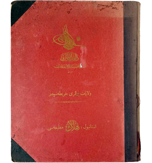
DAHİLİYE NEZARETİ [OTTOMAN INTERIOR MINISTRY].
[Dahiliye nezareti umür-i mahalliye ve vilayet müdüriyeti vilayet yolları haritasıdır. / The Ministry of Internal Affairs Map of the Provinces and their High Roads].
Istanbul: Dahiliye Nezareti Umur-ı Mahalliye-i Vilâyat Müdiriyeti, Hilâl Matbaası,
1329 Rumi Calendar [1913].
Small Folio: 26 bi-chrome double-page maps, plus interleaved 49 unnumbered text sheets, bound in original half black cloth over red boards with cover bearing the title and the Tughra of Sultan Mehmed V Reshad in gilt; all maps and text entirely in Ottoman Turkish (Very Good, internally clean with sporadic foxing and staining, sporadic small tears inmargins, sporadic text page loose in hinges, binding with tiny dents).
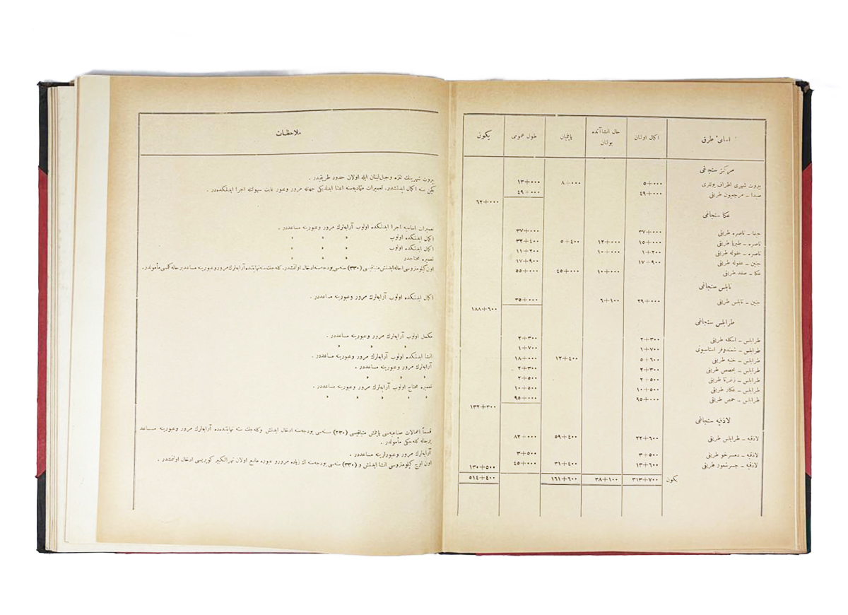
This is one of the rarest and most extraordinary works of late Ottoman cartography, being the only official large-format Ottoman transportation atlas, produced by the Interior Ministry at the behest of the ‘Young Turks’ regime on the eve of World War I. Published with text entirely in Ottoman Turkish, the atlas consists of 26 double-page maps, all of an extraordinary proto-modernist design, accompanied by detailed text explaining all of the road itineraries depicted. All of the maps are original productions, predicated upon the latest official sources supplied by both state engineers and private contractors. Of the maps, 8 focus exclusively upon subjects from the Arab World, including a dedicated map of the Hejaz (with the Hejaz Railway and pilgrimage routes), as well as a map focussing upon Mecca and Jeddah. The atlas provides by far and away the most comprehensive and accurate record of the road system throughout the Ottoman Empire, taken in the wake of an unprecedented wave of infrastructure development. Additionally, while not part of the technical remit of the work, the maps also provide a stellar overview of the Ottoman railway system, including the Hejaz Railway and the in-progress Anatolian-Baghdad Railway. The atlas therefore gives the most authoritative historical accounts of the technical nature of the empire’s key corridors of military and commercial movement, as well as the most important routes of the Hajj Pilgrimage, during a critical historical juncture.
The present atlas was created by the Ottoman Interior Ministry, which had auspices over the imperial Department of Public Works. In this capacity it oversaw all funds for road construction in the empire, as well as managing the construction and maintenance arrangements with (the often foreign) contractors. The stated purpose of the atlas is to showcase the current extent and condition of the empire’s roads as they were in 1913, the year before the Ottoman Empire made the fateful decision to enter World War I on the Central Powers side. Importantly, the empire, while still enormous, is shown in its truncated form in the wake of the Italo-Turkish War (1911-2) and the First Balkan War (1912-3), during which the Sublime Porte lost Libya and almost all of its European territories. As such the realm consisted of what it today the Republic of Turkey, plus it Arab World territories in the Levant, Iraq and Red Sea coast of Arabia, extending through Hejaz down to Yemen. As Ottoman road funds were distributed at the provincial (or vilayet) level, the atlas is divided into individual road maps of each of the empire’s vilayets, plus a few special maps focussing upon areas of heightened importance.
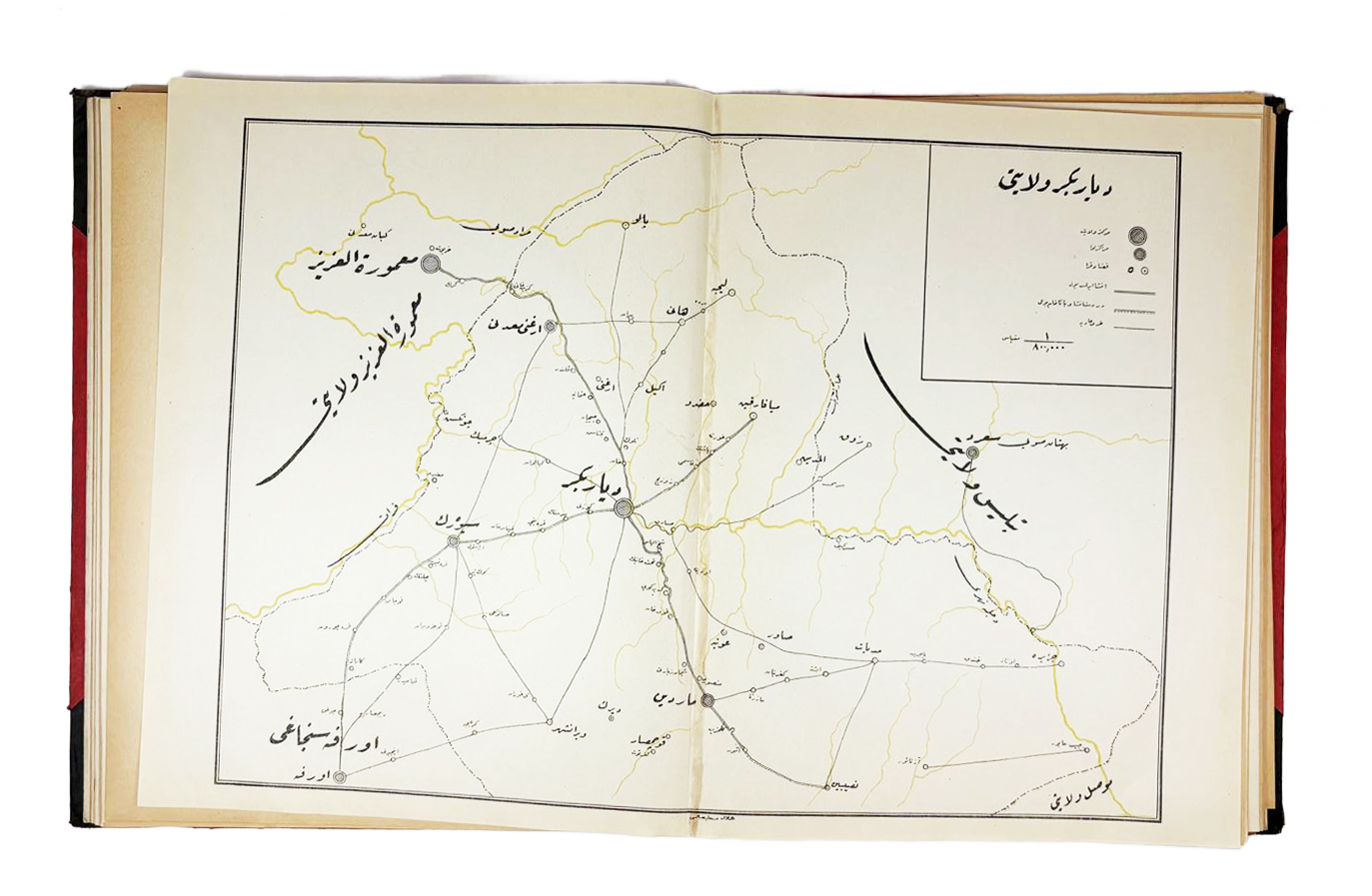
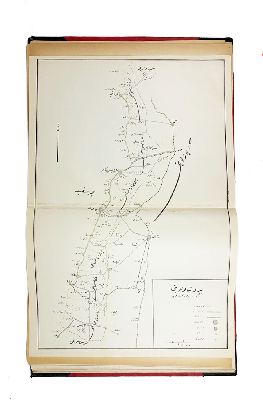
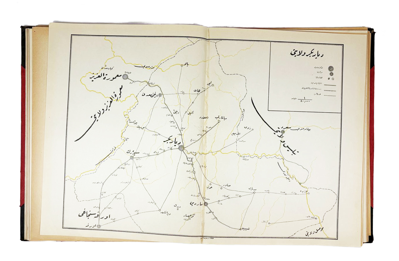
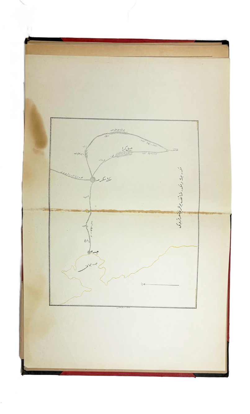
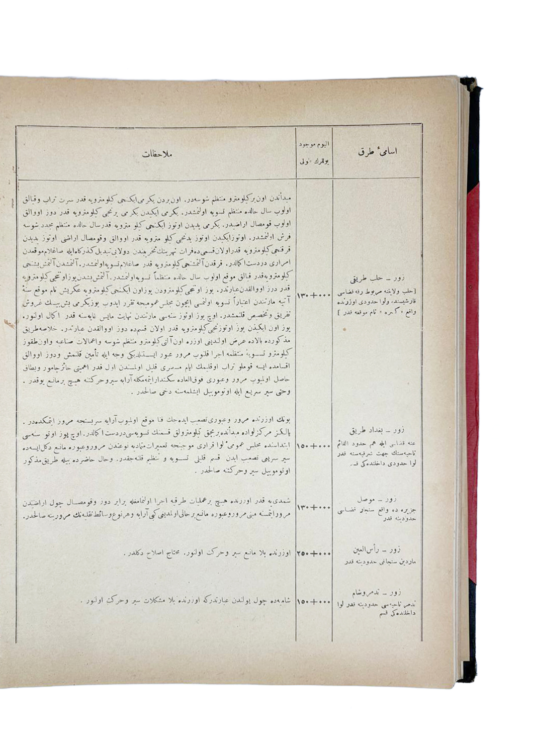
The proto-modernist design of the atlas’s maps and their relationship to the text is extraordinary, being many years ahead of their time. At first glance the maps seem remarkably simplistic, but this is deceiving, as they are actually highly sophisticated visual devices. By intent, the maps feature only vital information, including the locations of major cities, towns and transport junctions, as well as the routes of the major roads and railways, all printed in a minimalistic form in black. While the legend on each map identifies the symbols used to distinguish the nature of the routes (macadam vs. gravel roads; railways, etc.), and seminal details, such as the locations of major bridges and mountain ranges, are also present, the emphasis is upon clarity and economy of expression; all superfluous detail is intentionally omitted. Beyond that, all coastlines, rivers, lakes and waterways are present, but are coloured in a faint yellow hue, so as not to distract the eye from the critical transportation information. Free of clutter, the maps ingeniously allow one to instantaneously process the routes of the roads and railways, being the seminal purpose of the work. However, while the map may be by intent minimalistic, the accompanying text, largely made up of charts, is highly detailed providing by far and way the most acute and precise statistical record of the Ottoman road system ever published. For every map, there is an accompanying chart noting ‘Yolların İsimleri’ (Names of Each Road); as well a distinguishing ‘Şose’ (Macadam Roads); ‘Tesviye-i Türabiye’ (Levelled Gravel Roads); and ‘İnşa Edilmemiş’ (Unbuilt roads), with the exact distances given for each segment of every route; while the ‘Toplam Uzunluk’ (Total Length) of every route is likewise given. The text also provides, in some cases lengthy, notes on special features or hazards of the various routes.
The atlas’s use of intentionally minimalistic maps, backed up by detailed textual data, is way ahead of its time. Indeed, in 1913, even the most advanced transportation maps tended to be visually heavy, cluttered with data. The cartographers at the Ottoman Interior Ministry responsible for the present work were clearly very familiar with some of the novel experiments in cartography that were being undertaken in France and Germany at the time, but which had not yet gained common currency. The decision to adapt such progressive techniques to the Ottoman context, to create such arresting, entirely original maps, was a bold move, especially for such an important official project. However, upon close inspection of the atlas, even today’s viewer cannot help but to be impressed by the amazingly futuristic nature and technically brilliant aspect of the maps.
Of the 26 maps in the atlas, 23 focus upon a vilayet, while 3 maps (Bolou Sanjak (Zonguldak); the Çatalca Line; and Mecca & Jeddah) focus upon specific places within vilayets that were of special interest. The atlas covers every part of the Ottoman Empire, except for three jurisdictions: the Mutasarrifate of Jerusalem; the Vilayet of Yemen and the Vilayet of Basra. These areas were intentionally excluded, as the Ottoman Interior Ministry did not have jurisdiction over these regions for the purposes of infrastructure development. Of the maps, 18 focus upon areas that essentially correspond to regions within what is today the Republic of Turkey, while 8 of the maps feature regions in the Arab World (modern-day Saudi Arabia, Syria, Lebanon, Jordan, Iraq, plus Israel/Palestine).
The 26 Maps are as follows (listed in the order in which they appear in the atlas):
1) Angora (Ankara) Vilayet: Located high along the Anatolian Plateau, this province was home to Ankara, the future capital of the Republic of Turkey. Considered to be the ‘breadbasket’ of Anatolia, due to his wheat production, the map shows that many new macadamized roads had been built through the region so that produce could better reach market. Additionally, Ankara is shown joined to Istanbul by rail, a line that was completed at the end of 1892.
2) Adana Vilayet: This region, along Turkey’s south coast, produced vast quantities of semi-tropical cash crops and occupied a key stage along the Anatolian-Baghdad Railway.
3) Aydin Vilayet (Izmir): This province features Izmir (Smyrna), the empire’s second most important port, and takes in the south-western corner of Anatolia. It hosted several of the empire’s key trading routes, including macadamized roads and railways.
4) Constantinople (Istanbul) Vilayet: This map depicts the greater Constantinople region (Istanbul), the imperial capital, straddling Europe and Asia. It shows many macadamized roads radiating from the city, as well as the termini of the both of the Rumelian Railway (Orient Express) and the Anatolian-Baghdad Railway.
5) Adrianople (Edirne) Vilayet: Here the picture takes in most of what remains of Ottoman Europe, being Eastern Thrace, including the venerable city of Adrianople (Edirne), a former imperial capital. It hosts all the key roads connecting the empire with the rest of the continent, as well as a key stretch of the Rumelian Railway (Orient Express). The map also depicts the Gallipoli Peninsula, soon to be the scene of spectacular military events.
6) Erzurum Vilayet: The strategically vital region was to feature improved roads, as it was considered to be the empire’s great defensive bulwark against attack from Russia (indeed, it would become major battlefront during World War I).
7) Beirut Vilayet: This important map showcases the Vilayet of Beirut, which included virtually all of modern Lebanon, plus adjacent parts of Palestine and Syria. It extends along the Levantine coast, from just past Nablus (Palestine) in the south, all the way up to Latakia (Syria), in the north. Forever a globally important trading centre the region is crossed by several key commercial corridors as well as Hajj routes and other pilgrimage itineraries. Of note is the Beirut-Damascus macadamized road; the Beirut-Damascus Railway (completed in 1895); the Jezreel Valley Railway (completed in 1905), which connects the key port of Haifa to Dera’a (along the Hejaz Railway); and the Homs-Tripoli Railway (completed in 1911).
8) Baghdad Vilayet: This province occupies the heart of historical Mesopotamia, and features Baghdad, the great centre of commerce and learning. It anchored a region of vast agrarian wealth (also thought by some to be rich in oil!) and was in 1913 the focus of a grand Ottoman-German design to link Berlin to the Persian Gulf by way of the Berlin-Baghdad Express (the main component of which was the Bagdadbahn, or Anatolian-Baghdad Railway, which while being built was still far from complete). The region would soon be the scene of intense warfare between Britain and Ottoman-German forces.
9) Bitlis Vilayet: A strategically important province in Turkey’s Anatolian heartland.
10) Hejaz Vilayet: This is a stellar map of Hejaz that focuses upon the line of the Hejaz Railway, which was completed as far a south as Medina in 1908. The railway, which roughly follows the route of the legendary Syrian Hajj Road (which runs from Damascus to Mecca), labels all stations along the line. Additionally, the map shows the routes of the region’s road system, notably the Yembo-Medina Road, Media-Mecca Road, and what is today known as the Old Mecca-Jeddah Road, which were long critical routes for Hajj pilgrims. Key caravan routes are also shown leading to the Najd and Aqaba (a place soon to be made famous by Lawrence of Arabia and his Arab allies).
11) Aleppo Vilayet: This sprawling vilayet makes up north-western Syria and extends deep into southern Anatolia. It features the famous trading centre of Aleppo and the port of Iskenderun (Alexandretta). The region, being the gateway to the Levant, was traversed by critical highways and Hajj pilgrimage routes, as well as occupying a vital place along the emerging Anatolian-Baghdad Railway.
12) Hüdavendigâr (Bursa) Vilayet: A wealthy province located along the south shore of the Sea of Marmara, featuring Bursa, a former imperial capital.
13) Diyarbakir Vilayet: This is a strategically important region making up the Kurdish heartland.
14) Syria (Damascus) Vilayet: A vital province containing what is today southern Syria and most of Jordan. The provincial capital, Damascus, was a key transport hub, being the departure point of the Syrian Hajj Road, the 1307 km-long route from Damascus to Mecca and the most legendary of all the great Islamic pilgrimage routes (today a candidate for UNESCO World Heritage Status); the head of the Hejaz Railway (since 1908); and one of the termini of the vital Damascus-Beirut macadamized road (completed in 1865). These vital routes, or portions thereof, are all clearly illustrated upon the map.
15) Sivas Vilayet: A keystone province in central Anatolia.
16) Trabzon Vilayet (Eastern Portion): Showcasing the eastern section of this elongated province, including the major Black Sea trading port of Trabzon; traversed by key routes following the ancient Silk Road to Persia.
17) Trabzon Vilayet (Western Portion): Containing the western part of this vilayet, including the port of Samsun.
18) Konya Vilayet: A large province in south-central Anatolia traversed by key highways and a critical section of the Anatolian-Baghdad Railway.
19) Kastamonu Vilayet: A resource-rich vilayet along the Black Sea in north-western Anatolia.
20) Mamuret-ul-Aziz (Harput) Vilayet: a strategically important vilayet near the headwaters of the Tigris and Euphrates rivers.
21) Mosul Vilayet: Comprising what is today Northern Iraq, one of the world’s largest oil deposits would soon be discovered there.
22) Van Vilayet: Home to the city of Van, located along the shores of the vast eponymous high-altitude lake.
23) Bolou Sanjak (Zonguldak): This special map focuses upon the Bolou Sanjak of the Kastamonu Vilayet, which was then a locus of major road construction owing to the area’s critical role in the empire’s participation in the Industrial Revolution; the region was home to vast natural resources, notably the coalmines of Zonguldak.
24) Untitled Map of ‘The Çatalca Line’: The special map shows the strategically vital section of the isthmus separating the Black Sea from the Sea of Marmara to the west of Istanbul. The so-called ‘Çatalca Line’ was considered to be the last stand of defence of the Ottoman capital, as was the case when the Bulgarian Army surged towards Istanbul in the early days of 1913, during the First Balkan War, just months before the present atlas was made; only concerted emergency action by the Ottoman Army saved the capital from capture. Naturally, the delineation of the roads in this region was of vital military interest, while the corridor is also crossed by the Rumelian Railway carrying the Orient Express.
25) Zor Vilayet: This vast desert vilayet takes up much of eastern Syria, and includes a good part of the upper Euphrates valley and the key caravan hub of Deir ez-Zor.
26) Mecca & Jeddah: This is a splendid map of the Mecca, Jeddah and Ta’if area of the Hejaz, featuring routes of the upmost importance to Islam. The holiest city of Mecca appears in the upper-right centre, while the Red Sea port of Jeddah is located to the left side and the city of Ta’if is present to the southeast of Mecca. The map labels the critical route today known as the Old Mecca-Jeddah Road that connected the holy sites to the port that was in the age of steamship travel the key disembarkation point for the faithful. Additionally, the map shows the beginning of the route from Mecca to Medina (the second holiest city in Islam), as well as the two main alternative roads form Mecca to Ta’if, itineraries imbued with tremendous religious significance. Despite the area’s extreme importance, maps focussing closely in upon the Mecca-Jeddah area are surprisingly uncommon.
A Note on Rarity
The present atlas is exceedingly rare. It would have been issued in only a very small print run for exclusive circulation to senior Ottoman civil and military officials. Upon the commencement of World War I, the atlas would have been ‘restricted’, as it contains militarily sensitive information. Printed on thin, fragile paper, its survival rate would have been low.
We can trace 3 institutional examples of the atlas in Turkish institutions. We are aware of a single other example on the market. In 2023, we owed another example (catalogue September 2023) and is now housed at NYU Abu Dhabi (OCLC 51297423). It is the only example, that we could trace on Worldcat.
References: ÖZEGE, no. 22737; Türkiye Diyanet Vakfı – İslâm Araştırmaları Merkezi (İSAM) [Turkey Diyanet Foundation – Centre for Islamic Studies, Istanbul]: 912.95607 VİL.Y; Dâhiliye Nezareti Umur-ı Mahalliye ve Vilayat Müdürlüğü Evrakı [Archives of the Turkish Interior Ministry, Ankara]: DH. UMVM. 74/31; İstanbul Büyükşehir Belediyesi Atatürk Kitaplığı [Istanbul Metropolitan Municipality Atatürk Library], No. 23589; OCLC: 51297423 [listing the work, but not citing the locations of any examples]; [Re: Citations in Recent Academic Publications]: Emre EROL, The Ottoman Crisis in Western Anatolia: Turkey’s Belle Epoque and the and the Transition to a Modern Nation State (London, 2016), pp. 73 and 301; Ahmet KISA, ‘II. Meşrutiyet Dönemi’nde Bitlis Vilayeti’nde Karayolları’ [Highways in Bitlis Province During the Second Constitutional Era], Tarih ve Gelecek Dergisi, Aralık 2019, Cilt 5, Sayı 3 [Journal of History and the Future, December 2019, Volume 5, Issue 3], pp. 702-11, esp. pp. 707-8.


