-
- Europe
OPERATION BARBAROSSA / WORLD WAR II: 圖要ソ・獨ふ闘 [Soviet Union and Its Sole Fight]
- 850.00€
- An ephemeral Japanese map illustrating Operation Barbarossa in September 1941 highlights the complex relations between Japan, the Soviet Union, and the Axis powers during World War II. Colour lithography, 53 x 75 cm (21 x 29.8 inches) (soft folds).
- Add to cart
-
- Czech Republic, Europe, Photography
ORIENATLISM IN PRAGUE: Linguistische Verein in Prag [Linguistic Society in Prague]
- 550.00€
- A photograph of today little known Prague-based Linguistic Society, joining the prominent Austro-Hungarian researchers of Africa, as well as Indian, Arabic and Classical languages. Gelatin silver photo, contemporary mounted on thick card, manuscript numbers recto in margin, black manuscript in black ink and pencil on the back, 12 x 16,5 cm (4.7 x 6.5 inches), (minor foxing verso,…
- Add to cart
-
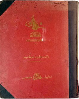
- Europe, Greece, Maps and Prints, Turkey
Ottoman Cartography / Rumelia: روم ايلى شهانه خريطه سى [Rumeli-yi şahane haritası also Rumeli-i şahane haritası / Map of Principality Rumelia]
- 1,400.00€
- A gigantic (over 2 m) wall map of Rumelia (Northern Greece) made by the Ottoman Military Office Colour lithography, composed of 12 plates, originally mounted on linen and varnished, with original wooden rollers, 124 x 210 cm (48.8 x 82.7 inches) (minor staining and water-staining, light scratches, small losses of image in the middle part, rollers with chipping…
- Add to cart
-
- Europe, Maps and Prints, Turkey
Ottoman Cartography: استانبول بوغازى و جواري خريطه سى [İstanbul Boğazı ve civarı haritası / Map of the Bosporus and Its Surroundings]
- 1,200.00€
- A large separately published detailed map of Istanbul and the Bosporus, with their contemporary infrastructure and urbanism as developed by 1911, published by the Ottoman state press Colour lithography, 100 x 108 cm (39.4 x 42.5 inches), originally dissected in 24 segments and mounted on linen (good, used example, slightly age-toned, stained and with small ink-staining, linen with…
- Add to cart
-
- Europe, France, Maps and Prints, Ottoman Books, September 2023: 50 under 1000 EUR, Turkey, Turkica
OTTOMAN CARTOGRAPHY: بلفور Belfort
- 450.00€
- Photolithography, originally dissected in 8 segments and mounted on linen 74 x 103 cm (29.2 x 40.6 inches), (minor staining, sporadic annotations in pencil in Ottoman in margins, but overall in a good, use condition).
- Add to cart
-
- Maps and Prints, Turkey
Ottoman Geological Map: اناطولى علم ارض خريطه سى [Geological Map of Anatolia].
- 1,400.00€
- Rare and Important – the first proper geological map of Turkey; a large, separately published work created by the professors Damat Kenan and Ahmet Malik Sayar, issued by the imperial printer in 1920 during the twilight of the Ottoman Empire, forming the foundation for scientific and commercial discovery during the upcoming Turkish Republican Era; printed in Ottoman Turkish text with…
- Add to cart
-
- Balkans, Books, Bulgaria, Croatia, Europe, History, Hungary, Maps and Prints
OTTOMAN MILITARY ATLAS: محاربات مشهوره عثمانه البومى
- 3,500.00€
- [Muharebat-ı meşhure-i osmaniye albümü / Album of Famous Ottoman Battles] A monumental portfolio of the famous Ottoman battles, edited by a famous military leader Ahmed Muhtar Pacha during WWI to commemorate the glorious military past of the Ottoman Empire Folio. Title page, 33 unbound double page maps, partly printed in colours, with text, 5 single page maps,…
- Add to cart
-
- Balkans, Europe, Maps and Prints
Ottoman Mss. / Telegraph Map – Greece / North Macedonia / Albania: [No Title – Map of the Telegraph System in the Vilayets of Salonica, Monastir, Janina and Scutari].
- 1,800.00€
- A stellar, large format, original manuscript map of the telegraph system in the Ottoman Balkans, specifically in modern Greece, Northern Macedonia and Albania; with text entirely in Ottoman Turkish, it was drafted in 1889 seemingly as working document by the governmental administration that managed the empire’s telegraph network – an extraordinary survivor documenting a critical medium that revolutionized society during…
- Add to cart
-
- Arabic Books, Books, Maps and Prints, Middle East, Ottoman Books, Turkey, Turkica
Ottoman Thematic Cartography: داخليه نظارتى امور محليه ولايات مدیریتى ولايات يوللرى خريطه سى
- 9,500.00€
- Exceedingly rare – one of the great monuments of Late Ottoman cartography, being the only official large-format Ottoman transportation atlas, including 26 double-page maps of an original, ingenious proto-modernist design, of which 8 maps concern the Arab World, including 1 map showcasing Hejaz and 1 map depicting Mecca & Jeddah; backed by detailed text explaining numerous itineraries for the…
- Add to cart
-
- Czech Republic, Europe, Maps and Prints
Pan-Slavism / Prague: Upomínka na Národopisnou výstavu českoslovanskou v Praze 1895
- 1,400.00€
- [Souvenir of the Czechoslavic Ethnographic Exhibition in Prague 1895] Folding paper fan with a chromolithographed view on the front and poem on the back, mounted on wooden sticks, joined with a metal loop at the bottom, 35 x 64 cm (13.8 x 25.2 inches) (Very Good, with only minor wear to the folds).
- Add to cart
-
- Africa, Maps and Prints, Spain
PEÑÓN DE ALHUCEMAS, Spain / Morocco: Alhuzemas
- 750.00€
- A 1778 manuscript map of the Spanish fortification Peñón de Alhucemas, off the Moroccan coast, was made by a North German officer and engineer Philip Ernst Colson.
- Add to cart

![Nezavisna Država Hrvatska. Zeljeznicka mreza i ostali prometni putovi [Independent State of Croatia. Railways and Other Traffic Routes]](https://pahor.at/wp-content/uploads/2020/06/65102-265x331.jpg)
![OPERATION BARBAROSSA / WORLD WAR II: 圖要ソ・獨ふ闘 [Soviet Union and Its Sole Fight]](https://pahor.at/wp-content/uploads/2025/05/Feb25_710-copy-265x331.jpg)
![ORIENATLISM IN PRAGUE: Linguistische Verein in Prag [Linguistic Society in Prague]](https://pahor.at/wp-content/uploads/2023/03/Foto_2023-02-22_233702-265x331.jpg)
![Ottoman Cartography / Rumelia: روم ايلى شهانه خريطه سى [Rumeli-yi şahane haritası also Rumeli-i şahane haritası / Map of Principality Rumelia]](https://pahor.at/wp-content/uploads/2022/06/wall-265x331.jpg)
![Ottoman Cartography: استانبول بوغازى و جواري خريطه سى [İstanbul Boğazı ve civarı haritası / Map of the Bosporus and Its Surroundings]](https://pahor.at/wp-content/uploads/2022/06/Januarmap4538-copy-265x331.jpg)
![Ottoman Geological Map: اناطولى علم ارض خريطه سى [Geological Map of Anatolia].](https://pahor.at/wp-content/uploads/2021/06/69351-265x331.jpg)

![Ottoman Mss. / Telegraph Map – Greece / North Macedonia / Albania: [No Title – Map of the Telegraph System in the Vilayets of Salonica, Monastir, Janina and Scutari].](https://pahor.at/wp-content/uploads/2020/07/alb-265x331.jpg)