-
- Asia, Maps and Prints, South-East Asia
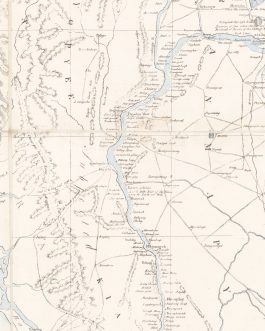
A Geographical Sketch of the Burmese Empire Compiled at the Office of the Surveyor General of India And published with Permission of Government At the Asiatic Lithographic Press / Calcutta 1825.
- 9,500.00€
- Extremely rare – the foundational modern map of Burma, being the first realistic general map of the country, as well as a monument of early lithography in India; the very large format work was published in Calcutta by the Asiatic Lithographic Press during the height of the First Anglo-Burmese War (1824-6), it served as an invaluable strategic aid for…
- Add to cart
-
- Asia, Maps and Prints, Newly Catalogued Items: August 2022, South-East Asia
INDONESIA – JAVA / CIREBON-KROYA RAILWAY: Opname Cheribon-Maos.
- 750.00€
- A seemingly unique engineer’s planning map of the Cirebon-Kroya Railway, a vital link that traversed the midriff of Java, connecting the north coast and south coast rail networks, likely made in 1912-3, just before construction was commenced on the project, which was completed in 1917; the map is printed by an unusual blue-tinted photolithographic technique and features the proposed…
- Add to cart
-
- Asia, Maps and Prints, South-East Asia
INDONESIA – SOUTHWESTERN SUMATRA (BENGKULU): [Untitled Chart of the West Coast of Sumatra, including Bengkulu (Bencoolen), extending to the Straits of Sunda].
- 750.00€
- Very Rare – the first broadly accurate British sea chart of the southwestern coast of Sumatra, a critical region home to the important British base of Benccoolon-Fort Marlborough (modern Bengkulu), published by William Herbert in 1758.
- Add to cart
-
- Asia, Maps and Prints, South-East Asia
INDONESIA – WEST JAVA (JAKARTA) / SUNDA STRAITS / SOUTHEASTERN SUMATRA: [Untitled Sea Chart of the Straits of Sunda, West Java, Southeastern Sumatra, Banka and Belitung].
- 850.00€
- Very Rare - the first broadly accurate British sea chart of the Straits of Sunda, but also extending to include West Java (including Jakarta) and southeastern Sumatra, published by William Herbert in 1758.
- Add to cart
-
- Asia, Maps and Prints, South-East Asia
INDONESIA – WEST SUMATRA / PADRI (MINANGKABAU) WAR: “Etappe-Kaart van het Militair Kommando, Westkust Sumatra. Schaal van 16 Palm op 1 duim Rh”.
- 2,800.00€
- An unique and extraordinary artifact of the successful Dutch endeavours to gain colonial dominion over West Sumatra during the 1830s, in the wake of the Padri War (concluded 1837) and the 1832 intervention against the Aceh Sultanate, being an impressively detailed original manuscript itinerary map of West Sumatra, including it rugged Minangkabau Highlands, depicting a dense archipelago of villages and…
- Add to cart
-
- Asia, Maps and Prints, South-East Asia
JAKARTA (BATAVIA), INDONESIA: [A Pair of Original Watercolour Views of Important Colonial Buildings in Batavia (Jakarta), Dutch East Indies (Indonesia)].
- 950.00€
- A pair of attractive and richly composed original 19th century watercolour views of two of Batavia’s (Jakarta, Indonesia) most important colonial buildings, being the ‘Willemskerk’ and the Residence of the Commander-in-Chief of the Dutch Army in the East Indies; executed by “D. Colleart” – a rare find, as very few original manuscript views of Batavia from the era survive.#…
- Add to cart
-
- Asia, Maps and Prints, South-East Asia
Malaysia Wall Map / Chinese Malaysians / Hong Kong Imprint: Newest Wall Map of Federation of Malaya. / 馬來亞聯合邦掛圖
- 1,500.00€
- A very rare wall map of the Federation of Malaya (today’s peninsular Malaysia) made only the year after its independence from Britain, an entirely bilingual work (Chinese-English) executed by a Chinese draftsman, Li Menphy, and published in Hong Kong for the benefit of Malaya’s large Chinese population and the many Hong Kongers who had strong connections to that country…
- Add to cart
-
- Asia, Maps and Prints, South-East Asia
SAIGON, VIETNAM – ORIGINAL MSS. FIRST URBAN PLAN / ASIAN URBANISM: “Batiments Civils / Saigon, projet de ville de 500.000 âmes. Corps Expedtionnaire de Cochinchine / Marine et Colonies”.
- 35,000.00€
- Lucien Florent Paul COFFYN (1810 - 1871). Manuscript, [Saigon, April-May 1862]. Manuscript, pen and ink and grisaille wash on paper, bearing three original manuscript signatures, being those of the author, draftsman and colonial governor, mounted upon a larger piece of 20th century paper (Good, wear along old folds with some minor loss at some fold vertices, some short closed tears…
- Add to cart
-
- Asia, Maps and Prints, New Acquisitions: December 2020, South-East Asia
SINGAPORE & BORNEO
- 320.00€
- A map from Umûm Vilayât-ı Şâhâneyi Hâvi Küçük Atlas - Umûmî Küçük Atlas (General Small Atlas) Chromolithograph. 9 x 13,5 cm (3.5 x 5.3 inches).
- Add to cart
-
- Asia, Maps and Prints, New Acquisitions: September 2020, South-East Asia
SINGAPORE & SUMATRA: صوماطرا اطيه سى [Island Sumatra]
- 230.00€
- Chromolithograph. 10 x 13,5 cm (4 x 5.3 inches). Slightly stained, overall in a good condition.
- Add to cart
-
- Asia, Maps and Prints, South-East Asia
Vietnam / Cambodia / Laos (Indochina) / French Conquest Of Vietnam: Carte de L’Indo-Chine Orientale dressée par Mr. J.L. Dutreuil De Rhins publiée sous le Ministère de Mr. le Vice Amiral Jaureguiberry. Au Dépôt des Cartes et Plans de la Marine en 1881.
- 6,500.00€
- A colossal monument of the cartography of Indochina, being the grand ‘Headquarters Map’ of Vietnam, Cambodia, Laos and eastern Siam commissioned by the French Government in anticipation of their bold designs of expansion in the region that led to the Tonkin Campaign (1883-6), the complete conquest of Vietnam; showcasing by far and away the most accurate and detailed general…
- Add to cart


![INDONESIA – SOUTHWESTERN SUMATRA (BENGKULU): [Untitled Chart of the West Coast of Sumatra, including Bengkulu (Bencoolen), extending to the Straits of Sunda].](https://pahor.at/wp-content/uploads/2020/06/65412-265x331.jpg)
![INDONESIA – WEST JAVA (JAKARTA) / SUNDA STRAITS / SOUTHEASTERN SUMATRA: [Untitled Sea Chart of the Straits of Sunda, West Java, Southeastern Sumatra, Banka and Belitung].](https://pahor.at/wp-content/uploads/2020/06/65427-265x331.jpg)

![JAKARTA (BATAVIA), INDONESIA: [A Pair of Original Watercolour Views of Important Colonial Buildings in Batavia (Jakarta), Dutch East Indies (Indonesia)].](https://pahor.at/wp-content/uploads/2022/07/bat2-265x331.jpg)


![SINGAPORE & SUMATRA: صوماطرا اطيه سى [Island Sumatra]](https://pahor.at/wp-content/uploads/2020/08/2020-08-17_184006-265x331.jpg)
