-
- Maps and Prints, Middle East
MIDDLE EAST / ARABIAN PENINSULA /CAIRO: مصر ايالتى [Misir Eyalet-i / The Eyalet of Egypt]
- 680.00€
- Chromolithograph, 51 x 34 cm (13.4 x 20 inches), (small repaired tears in the fold, sporadic light staining in white margins, but otherwise in a good condition). Istanbul: Matbaa-I Amire [1307-1309 AH [1891-1893 AD] Atlas] – Mahmud Bey Matbaası 1309 AH [1893 AD] [date on the map].
- Add to cart
-
- Maps and Prints
MILLITARY CARTOGRAPHY / SAXONY, GERMANY: Map of a Military Field by Zeithein [Plan des Lagers bei Zeithain]
- 280.00€
- A rare map with blank spaces, meant to be filled in by hand, was printed to showcase the drill of the military troops of the Electorate of Saxony in the area between Leipzig and Dresden.
- Add to cart
-
- Europe, Greece, Maps and Prints
MILOS / GREECE: Milo insula posta nel mare dello Arcipelago longi dalla Morea…
- 500.00€
- Camocio’s separately issued map of the Greek island Milos with handsome old colouring Originally coloured copper engraving, 20 x 14,5 cm, mounting paper: 21,5 x 19 cm (minor staining, a tiny repaired tear in the white margin, but overall in a good condition).
- Add to cart
-
- Europe, Maps and Prints, Turkey
Moltke’s Map of the Bosporus: Karte des nördlichen befestigten Theils des Bosphorus von den Hissaren bis zu den Leuchtthürmen am Schwarzen Meer im Auftrage Sr. Hoheit Sultan Mahmud II. Mit dem Messtisch in 1 : 25,000 aufgennommen 1836-37 durch Freiherrn von Moltke.
- 3,800.00€
- A rare map of the Bosporus commissioned by Ottoman Sultan Mahmud II and created by Prussian military surveyor Helmuth von Moltke. Lithography with original colour in outline, 73,5 x 68 cm (29 x 26,77 inches), dissected in 20 segments and mounted on linen. An advertisement of Artaria, Vienna, on green paper mounted on one of the segments verso. Housed…
- Add to cart
-
- Maps and Prints
MONTENEGRO: Народна република Црна Гора [Narodna republika Crna Gora].
- 380.00€
- A large wall map of Montenedro, was published in Montenegro in 1948, in the year of the the schism between Yugoslavia ans Albania, an event which had great consequences for Montenegro and surrounding regions.
- Add to cart
-
- Maps and Prints
MOON: Telescopic appearance of the Moon.
- 250.00€
- An attractive translucent map of the moon, printed on a thick paper, and backed with thin blue paper.
- Add to cart
-
- Africa, Maps and Prints
MOROCCO – Essaouira (Mogador): Verklaaring van deeze Paskaart Sedy Besorktom is de Graf plaats van een Marabouw, hebbende rondom de muer cenige spitze Naaden, Zynde een goed merk als men uit het Noorden komt om niet roorby Magodor te zeilen t Rif Teran va
- 750.00€
- An extremely rare separately-issued chart of the important port of Essaouira (formerly Mogador), Morocco, issued when the city was being transformed into the country’s greatest port, by Gerard Hulst van Keulen, masterfully engraved and of an uncommonly beautiful design.
- Add to cart
-
- Africa, Maps and Prints
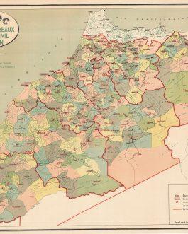
MOROCCO: Mapa de Marruecos / Protectorado Español / Escala 1:200.000 / Diciembre de 1927 / Edición provisional.
- 2,200.00€
- MOROCCO (SPANISH / NORTHERN) / RIF WAR: CUERPO DE ESTADO MAYOR DEL EJÉRCITO. Madrid: Talleres del Depósito de la Guerra, December 1927. Colour photolithograph, on 6 untrimmed and un-joined sheets of thick paper, housed in decorative printed paper sleave bearing blindstamp of the ‘Depósito de la Guerra’, rolling into original crimson tube bearing title in silver lettering (Very…
- Add to cart
-
- Africa, Maps and Prints
MOROCCO: امغرب السياحي أقاليم الشمال Reiseland Marokko. Die Nordprovinzen [Tourist Country Morocco. North Provonces]
- 320.00€
- Colour print, printed from both sides, 43 x 60 cm (17 x 23.6 inches) (soft folds, otherwise in a good condition).
- Add to cart
-
- Maps and Prints
MOSCOW, WWII: Разгром немецко-фашистичких войск под Москвой [Razgrom nemecko-fašističkih vojsk pod Moskvoj / The Route of the German Fascist Troops near Moscow].
- 400.00€
- A rare poster map, showing the Battle of Moscow and Stalin, was published by the Higher School of Communist Party of the Soviet Union, the highest educational institution on the Soviet Union.
- Add to cart
-
- Maps and Prints
MOSCOW: ПЛАНЪ r. МОСКВЬІ (Plan of Moscow).
- 320.00€
- An attractive Pre-Revolution Plan of Moscow, printed in Cyrillic text.
- Add to cart
-
- Asia, Japan, Maps and Prints
MOUNT FUJI / GEOLOGICAL CHART: 富士山地質圖 [Fujisan chishitsuzu / Mount Fuji Geological map]
- 1,500.00€
- First modern, separately printed geological map of Mount Fuji Colour print on thin paper 95 x 75 cm (38.2 x 29.5inches) (slightly age-toned, soft folds, small holes on the crossings of the folds).
- Add to cart
-
- Africa, Maps and Prints, Newly Catalogued Items: August 2022
MOZAMBIQUE / LIMPOPO / RIVER ESTUARY (XAI-XAI, GAZA PROVINCE): Reconhecimento da barra do Limpopo. Costa Oriental de África. Província de Moçambique.
- 350.00€
- An extremely rare and important sea chart depicting the mouth of the Limpopo River, in southern Mozambique; for centuries the Limpopo was one of the great transport corridors into the interior of southern Africa; the chart is based upon groundbreaking scientific surveys by a team of Portuguese naval officers, led by João António Ludovice, conducted in 1893, when the…
- Add to cart
-
- Africa, Maps and Prints, Newly Catalogued Items: August 2022
MOZAMBIQUE / RIO MONIGA, PEBANE, ZAMBEZIA PROVINCE: Reconhecimento hydrographico da Barra do Rio Tejungo. Costa Oriental de África. Província de Moçambique.
- 350.00€
- An extremely rare and attractive late 19th century Portuguese sea chart of the mouth of the Rio Tejungo (today known as the Rio Moniga), a key trading port along the north-central coast of Mozambique, the chart being the first edition of the first scientific, trigonometric survey of estuary, conducted in 1898 by Lieutenant João Carlos da Silva Nogueira of…
- Add to cart
-
- Africa, Maps and Prints
MOZAMBIQUE & ANGOLA / ZIMABABWE / ZAMBIA / MALAWI / ANGLO-PORTUGUESE DISPUTES – ‘SCRAMBLE FOR AFRICA’: Questão Luso Britannico / Carta publicada pelo jornal O Comercio do Porto indicando os Novos Limites da Africa Meridional / segundo a convenção com a Inglaterra.
- 1,400.00€
- An exceedingly rare – 1 of only 3 known examples - and historically consequential map; its contents enraged the people of Porto, helping to fuel the Republican Revolt that occurred there on January 31, 1891; the map, which embraces the midriff of Southern Africa, depicts Portugal’s premier colonies of Angola and Mozambique with greatly reduced boundaries, to the benefit of…
- Add to cart
-
- Maps and Prints
MUNICH, Germany: Münich – Monumental.
- 250.00€
- Map of Munich made for the occassion of the Arts & Crafts Fair of 1908 as an advertisement by a world famous fabrics and clothing factory Lodenfrey, which specialised in Bavarian and early hiking clothing.
- Add to cart
-
- Americas, Maps and Prints, South America
Municipio de Buenos Aires y parte del Partido de Avellaneda publicado por Pablo Ludwig publicado por Pablo Ludwig, cartógrafo, según los datos mas recientes, 1909. Edición extraordinaria para la Exposición internacional de ferro-carriles y transportes terrestres, mayo á noviembre 1910.
- 380.00€
- An attractive and vibrant large format map of Buenos Aires, capturing the city midway through its 50 year-long boom era, when it was one of the world’s most exciting, fast growing and cosmopolitan metropolises – an ‘Edición extraordinaria’ issued to celebrate the 1910 International Railway Exposition, a major sign of the Argentine capital’s coming of age - published by the…
- Add to cart

![MIDDLE EAST / ARABIAN PENINSULA /CAIRO: مصر ايالتى [Misir Eyalet-i / The Eyalet of Egypt]](https://pahor.at/wp-content/uploads/2022/10/69872-265x331.jpg)

![MILLITARY CARTOGRAPHY / SAXONY, GERMANY: Map of a Military Field by Zeithein [Plan des Lagers bei Zeithain]](https://pahor.at/wp-content/uploads/2020/06/ott_75-265x331.jpg)


![MONTENEGRO: Народна република Црна Гора [Narodna republika Crna Gora].](https://pahor.at/wp-content/uploads/2020/06/65391-265x331.jpg)


![MOROCCO: امغرب السياحي أقاليم الشمال Reiseland Marokko. Die Nordprovinzen [Tourist Country Morocco. North Provonces]](https://pahor.at/wp-content/uploads/2022/03/maro-265x331.jpg)
![MOSCOW, WWII: Разгром немецко-фашистичких войск под Москвой [Razgrom nemecko-fašističkih vojsk pod Moskvoj / The Route of the German Fascist Troops near Moscow].](https://pahor.at/wp-content/uploads/2020/06/65521_1-265x331.jpg)

![MOUNT FUJI / GEOLOGICAL CHART: 富士山地質圖 [Fujisan chishitsuzu / Mount Fuji Geological map]](https://pahor.at/wp-content/uploads/2021/07/69380-265x331.jpg)


